
Listings and land
What kinds of property do you fly?
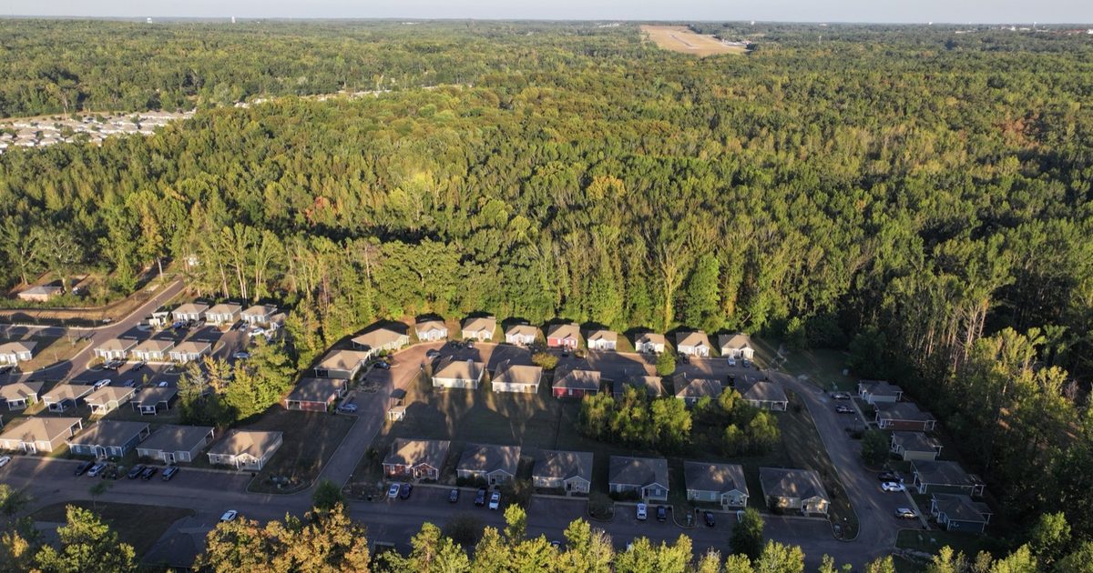
Homes, land and acreage, barns and pasture, storefronts, shopping centers and new developments. The aerials on my photo portfolio include the Acadia Loop homes in Oxford, commercial buildings and a barn with its fenced pasture.
Why use drone photos in a listing?
An aerial shows what ground photos can't: how much land comes with the house, where the pond and the tree line are, and how the property sits next to the road and the neighbors. On land and acreage it's often the photo that tells the story.
Photos, video or both?
Both work. Aerial stills go in the listing, and a short film that mixes aerial and ground shots works for the listing video, social and the agent's website, like the property film on my commercial page.
Can you shoot the ground photos too?
Yes. I'm a commercial photographer as well, so one visit can cover the aerials and the photos from the ground. My commercial photography page has the shoot sizes.

Planning the flight
Do you need anyone there?
Not always. I need the owner's permission to fly and a safe place to take off and land. Tell me about gates, livestock and anything else I should know before I pull in.
What's the best time of day?
For most homes, morning or late afternoon, when the low sun gives the roofline and the trees some shape. The Acadia Loop rooftops on my portfolio were shot in that low evening light. For open land, a clear midday sky shows the acreage evenly.
Can you fly near the Jackson airports?
Usually, with FAA authorization, which I request before I fly. Downtown Jackson, Belhaven, Fondren, Pearl, Flowood and Brandon are inside the FAA's grid around the Jackson airports; Madison, Ridgeland and Clinton weren't at the spots I checked. Part of Fondren needs a manual FAA request, so give me at least a week there. More in my drone Q&A.
And around Oxford?
Oxford and Lafayette County sit in open airspace at drone altitudes, so most listings need no FAA authorization. Ole Miss property is the exception: every flight there goes through UPD for approval, and home football games close the sky around the stadium. Details in my Ole Miss drone guide.
What if it rains?
Rain and strong wind ground the drone, so we pick a new time. I watch the forecast before the shoot and tell you the day before if it looks wrong.
Cost and delivery
How much does real estate drone photography cost?
I quote each property. The price depends on the size of the property, whether you want photos, a film or both, the drive and the airspace. Send me the address and what you need, and I'll reply with a quote, usually within a day.
How do I get the photos?
By private download link, sized for where they're going: the listing, a website or social.
Sources
Checked October 19, 2026. Rules change, so check the official pages before you fly.